🏆 Expert Verdict & Overview
MarineTraffic - Ship Tracking stands as the definitive leader in the maritime Maps & Navigation sector. By leveraging the world's largest network of land-based AIS receivers, the app provides an unparalleled real-time window into global shipping activities. It successfully bridges the gap between professional-grade maritime data and consumer-friendly accessibility, making it an essential tool for both industry professionals and maritime enthusiasts who require precise vessel positioning and port intelligence.
🔍 Key Features Breakdown
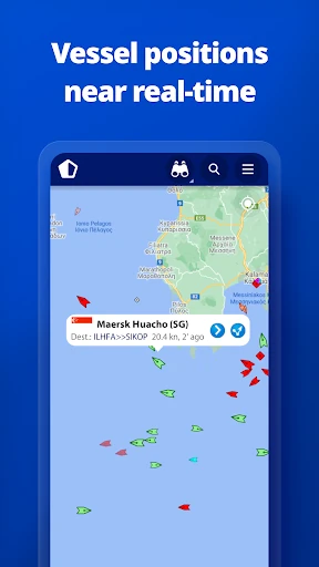
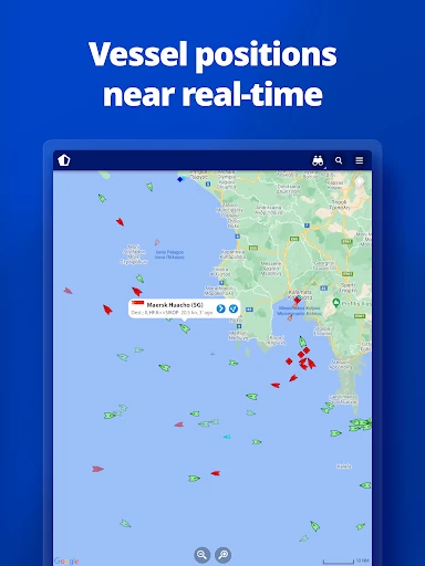
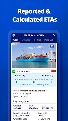
- Live AIS Vessel Tracking: Monitors over 300,000 vessels daily, allowing users to track specific ships or browse global traffic to enhance situational awareness.
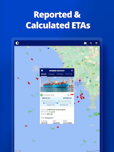
- Port Arrivals & Departures: Provides live updates for over 4,000 ports and marinas, helping logistics professionals and travelers manage schedules with estimated times of arrival (ETA).
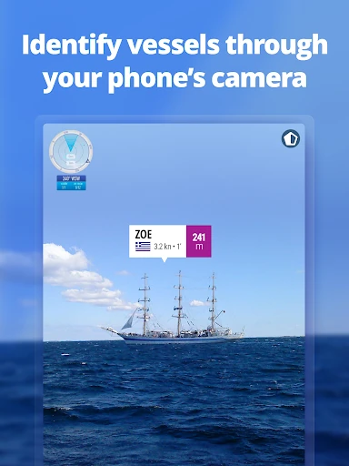
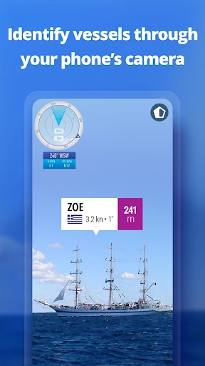
- Augmented Reality (AR) Tool: Solves the problem of ship identification at a distance by allowing users to point their device at the horizon to see vessel names, speeds, and flags overlaid on the camera feed.
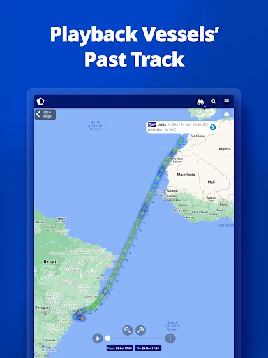
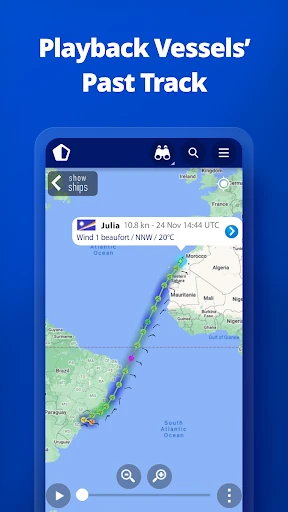
- Animated Playback: Offers a historical view of a vessel's track, which is crucial for analyzing shipping routes or investigating past maritime incidents.
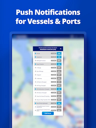
- "My Fleet" Synchronization: Allows users to manage a curated list of vessels that stays in sync across mobile devices and the web, ensuring consistent monitoring.
🎨 User Experience & Design
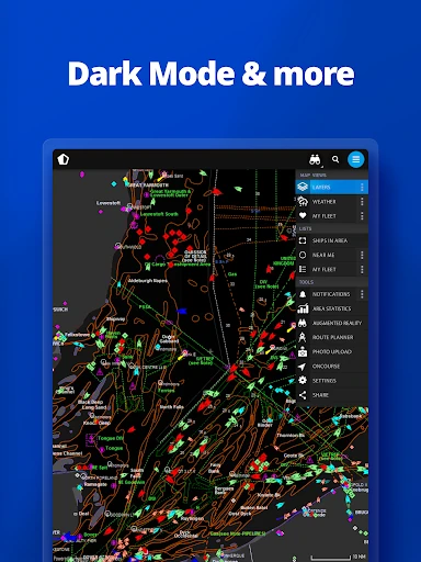
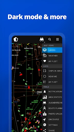
The interface of MarineTraffic is designed with a focus on data density and utility, characteristic of high-end navigation tools. Despite the vast amount of information displayed, the map remains responsive with intuitive pinch-to-zoom and search functionalities. The sidebar and filtering systems are logically organized, though the sheer volume of icons may present a slight learning curve for novice users. The integration of the AR tool is seamless, providing a high-tech "point-and-know" experience that feels native to the mobile platform.
⚖️ Pros & Cons Analysis
- ✅ The Good: Unmatched AIS coverage and accuracy across major global shipping lanes.
- ✅ The Good: Sophisticated AR identification feature that adds immense value for coastal ship-spotting.
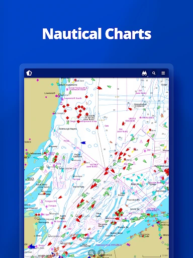
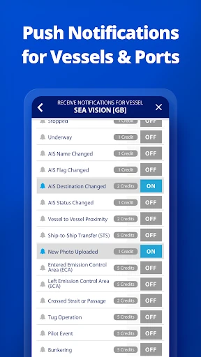
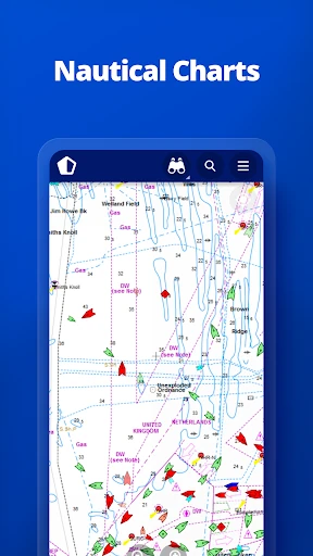
- ❌ The Bad: Advanced data such as Satellite-AIS and high-resolution nautical charts are locked behind additional subscription tiers or in-app purchases.
- ❌ The Bad: High resource consumption can lead to significant battery drain during prolonged live-map sessions.
🛠️ Room for Improvement
To further enhance the user experience, MarineTraffic could introduce a more robust offline caching mode for nautical charts, which would be invaluable for users in areas with poor cellular reception. Additionally, a simplified "Lite" interface mode could help improve performance on older devices that struggle with the high-density vessel rendering on the live map.
🏁 Final Conclusion & Recommendation
MarineTraffic - Ship Tracking is the gold standard for anyone needing to monitor the seas. It is a must-have for maritime professionals, yacht owners, ship spotters, and the families of seafarers. While the most advanced features require a financial commitment, the core functionality offers the most comprehensive maritime data set available on the Google Play Store. It remains the top recommendation for the Maps & Navigation category in the maritime niche.