Advertisement
Click to download now, finish the installation quickly, and directly unlock the all-round experience
Advertisement
Screenshots
Click to download now, finish the installation quickly, and directly unlock the all-round experience
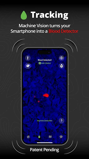
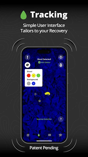
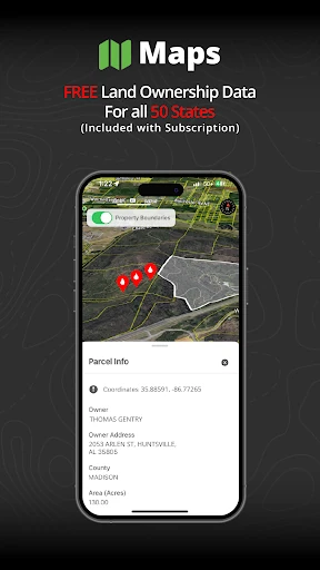
Track N Trail - Hunting & Maps enters the Sports landscape not just as another mapping utility, but as a specialized recovery tool that addresses one of the most stressful aspects of hunting: the recovery of wounded game. By integrating patent-pending machine vision technology, it positions itself as a high-tech companion for the ethical hunter. Its focused approach on blood detection and land ownership data sets it apart from generic GPS applications, offering a professional-grade solution for a niche yet critical outdoor need.
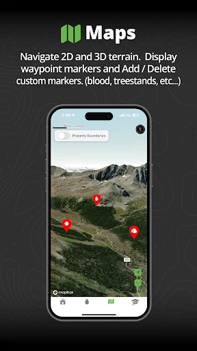
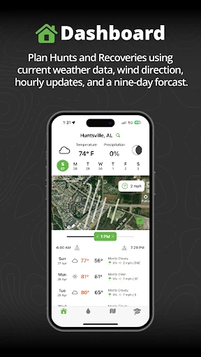
The design philosophy behind Track N Trail prioritizes clarity and utility in field conditions. The UI avoids the "feature bloat" common in the Sports category by offering a streamlined, single-tier subscription model that eliminates confusing menus. The inclusion of 3D terrain mapping enhances spatial awareness, while the "metal detector" style feedback for blood tracking is an intuitive UX choice that allows the user to keep their eyes on the physical environment while receiving digital assistance.
To further enhance the user experience, the developers should consider an offline-first mode that allows all parcel and map data to be cached, as hunters often operate in areas with zero cellular connectivity. Additionally, integrating an AR (Augmented Reality) waypoint system could help users visually "pin" blood droplets in 3D space through the viewfinder, creating a digital trail that persists even if the physical evidence is obscured.
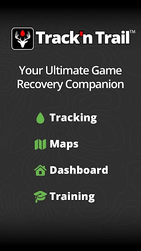
Track N Trail - Hunting & Maps is an essential tool for the modern hunter who values ethical recovery and legal compliance. It is specifically tailored for hunters who operate in diverse terrains across the United States and need more than just a GPS. With its powerful machine-vision technology and comprehensive landowner database, it is highly recommended for any sportsman looking to leverage technology for a more successful and responsible hunting season.